Treepedia


Cities around the world are recognizing this and many are developing strategies to increase green canopy cover. In fact, in 2015, the World Economic Forum’s (WEF) Global Agenda Council (GAC) on the Future of Cities included increasing green canopy cover on their list of top ten urban initiatives: “Cities will always need large—infrastructure projects, but sometimes small—scale infrastructure—from cycle lanes and bike sharing to the planting of trees for climate change adaptation—can also have a big impact on an urban area.”
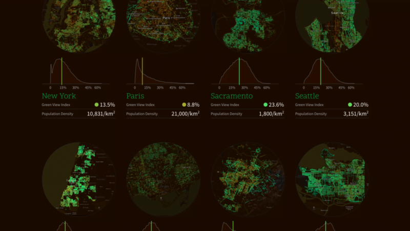
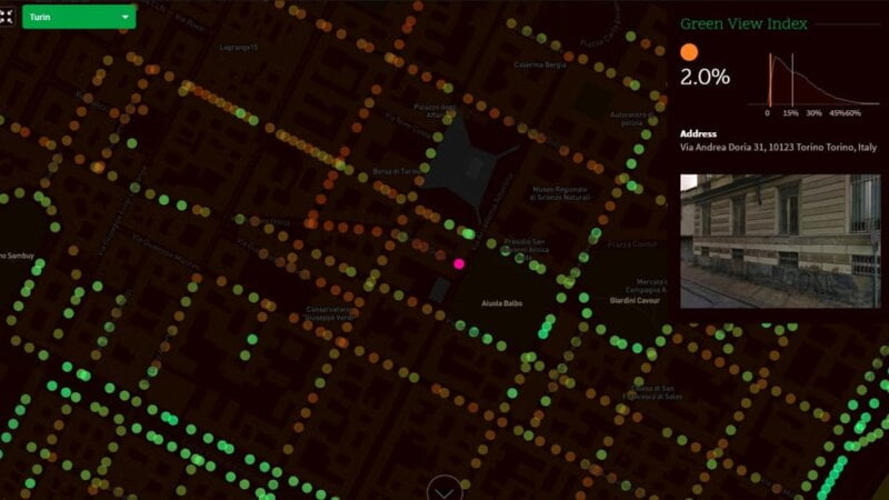
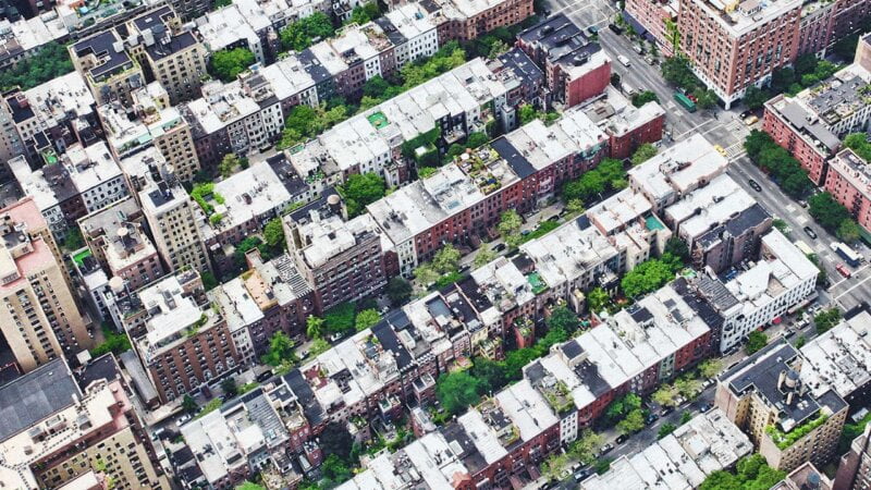
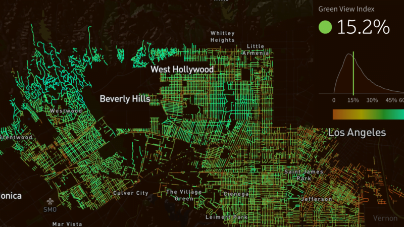
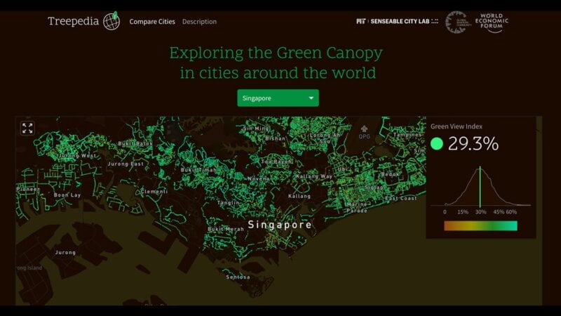
As cities around the world race to implement green canopy strategies, we’ve developed a metric—the Green View Index—by which to evaluate and compare canopy cover. In collaboration with the World Economic Forum’s Global Agenda Council on the Future of Cities and the World Economic Forum’s Global Shapers community, we will continue to grow this database to span cities all over the globe. Treepedia is not about rating cities to compete in a green olympics. Treepedia aims to raise a proactive awareness of urban vegetation improvement, using computer vision techniques based on Google Street View images. Our focus is on street trees: Treepedia doesn’t map parks, as GSV doesn’t venture into them as it does on average streets.
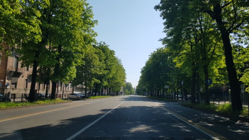
Of course, parks are an essential component of urban vegetation. But have you ever wondered how sustainable your street or neighborhood is? Does your city need more efforts to make the streets greener? Did you know that you can also contribute by joining a bottom-up approach instead of waiting for things to be done by politicians and planners

Share this listing...
![]()